This web includes a complete copy of the 1916 publication by Thos. Cook & Son Baguio and Northern Luzon,
which gives a very interesting insight into Baguio and
Northern Luzon just after the turn of the 20th century - from a tourist traveler's point of view. Included are contemporary photos and map of Baguio, as well as historical,
cultural and economic information. Also included are pictures from travels in Northern Luzon almost ninety years later.
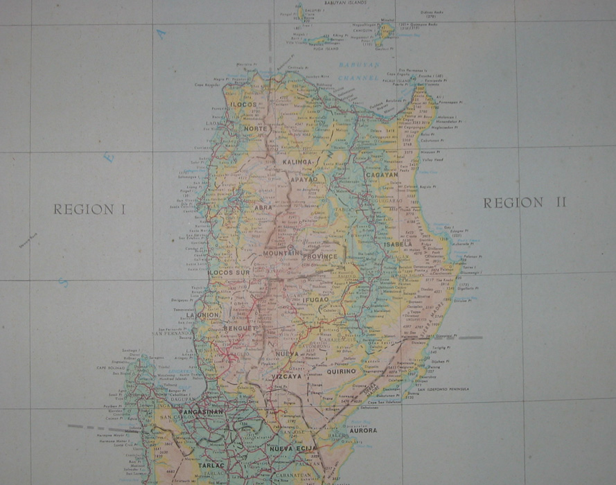
The pictures are from three trips to Nothern Luzon:
o Manila-Vigan-Ilocos Norte-Cagayan-Nueva Vizcaya-Aritao-Baguio-Manila on bike (Yamaha Tenere 650)
o Manila-Dalton Pass-Banaue-Sagada-Baguio-Manila with car (Mitsubishi Montero 2500)
o Manila-Cabanatuan-Baler-Cabanatuan-Manila on bike (Yamaha Tenere 650)
as well as a rafting trip to Chico River via Tabuk and several trips to Baguio.
Notes
Hans Fay
I found the Thomas Cook publication in a house I bought in Norway just after returning from five years in the Philippines. The house had formerly (some 15 years earlier), belonged to a retired Norwegian diplomat, Mr. Hans Fay (picture), one of the pioneers of Norwegian foreign service. Mr. Faye started as an attache in Paris in 1905 (the same year Norway's union with Sweden was dissolved), and later served in Sweden, Australia, New Zealand, Chile, India, United States and Mexico. In his memoirs (På Post i Fem Verdensdeler), he mentions arriving in Manila in January 1919 en route to Calcutta from Valparaiso. However, it seems he sailed on to Saigon shortly after, and it is doubtful that he visited Northern Luzon.

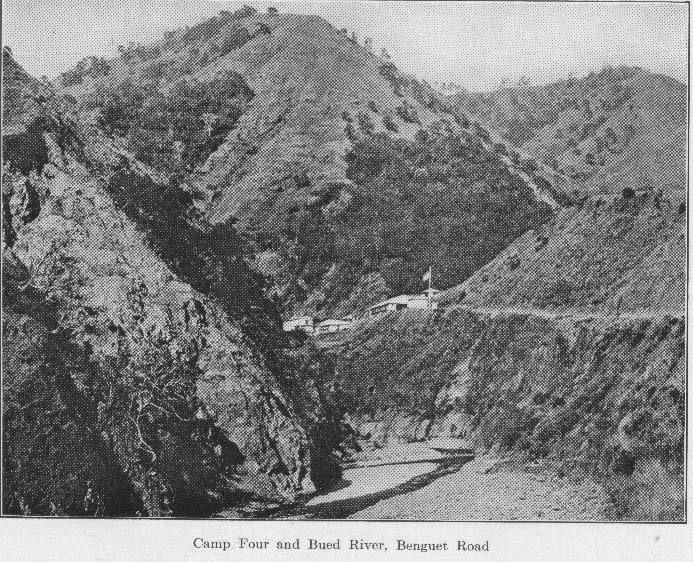
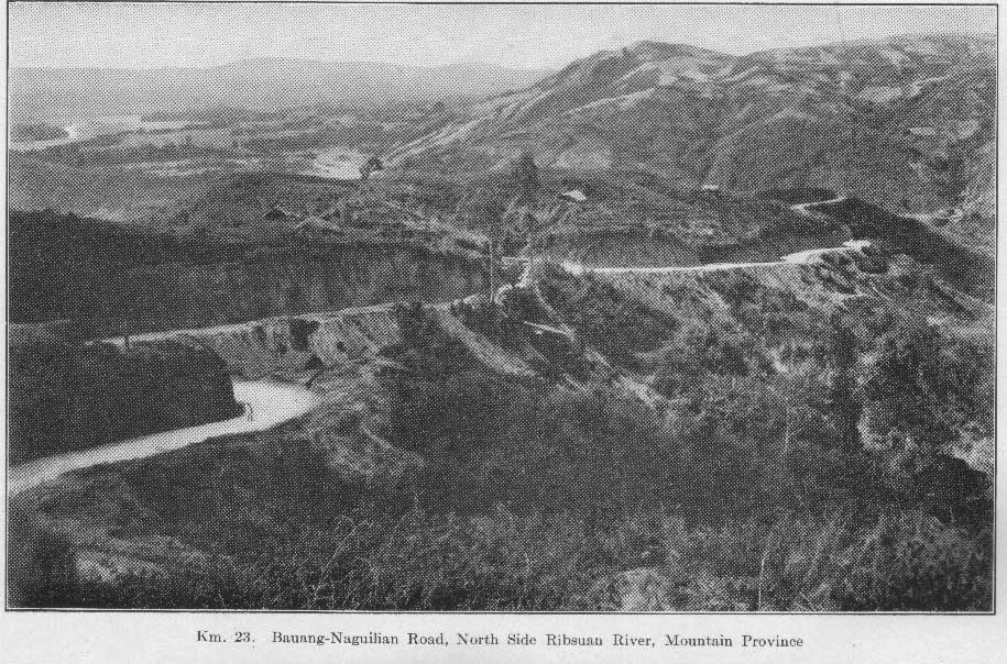
Deforestation
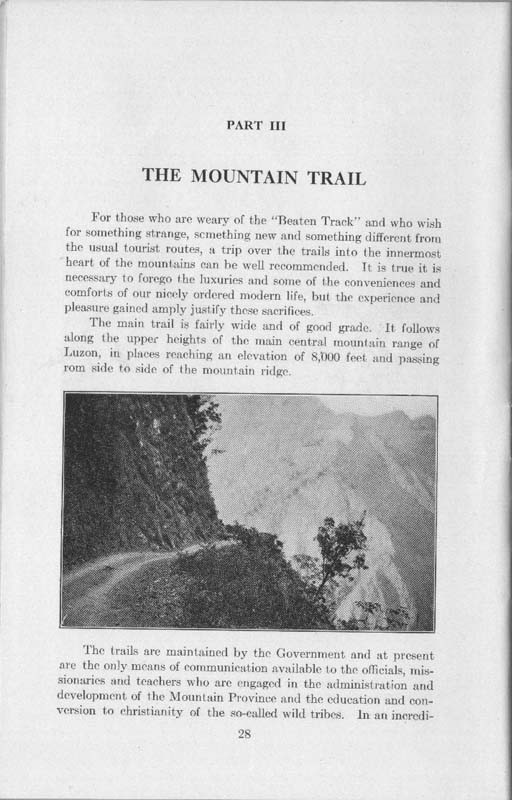
It is surprising to note that the mountains appear largely deforested - it raises the question whether the area's steep mountain-sides ever had a good forest cover. See Camp Four and Naguilian Road.
Other
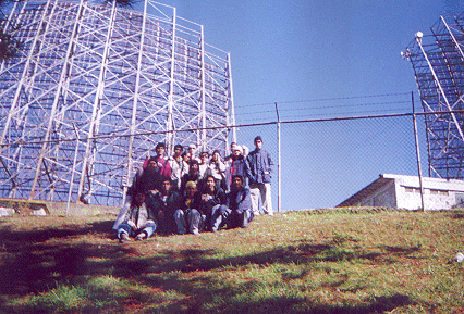
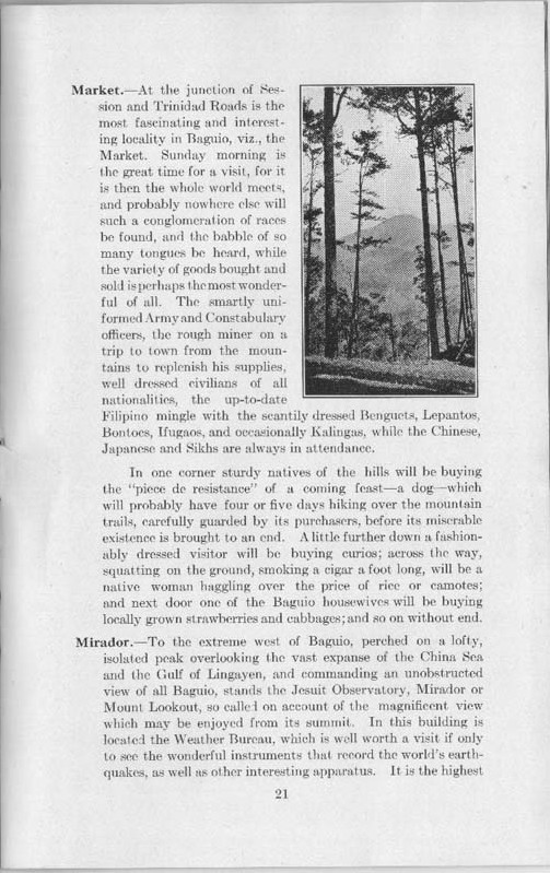
Among the more colorful pieces are the description of Baguio Market, the "so-called wild tribes" of Cordilleras and of Bontoc. Senor Sanchez refers to a climate in the Cordilleras as having occasional frosts. This is most likely an exaggeration as snow and ice are unknown at present times. Read the beautiful description of the breathtaking view from summit of Sto. Thomas (today the site of a radar station - Cabuyao, Tuba, Benguet).
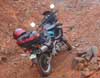
Road conditions (2003)
|
||||||||||||||||||||||||||||||||||||||||||||||||||||||||||||||||